PS120: Earth Science
Exploring Brazil
one of the most culturally rich countries, the most diverse Ecosystematic country in the World.

Bastião of the South: Depicting Atlas carrying brazil.
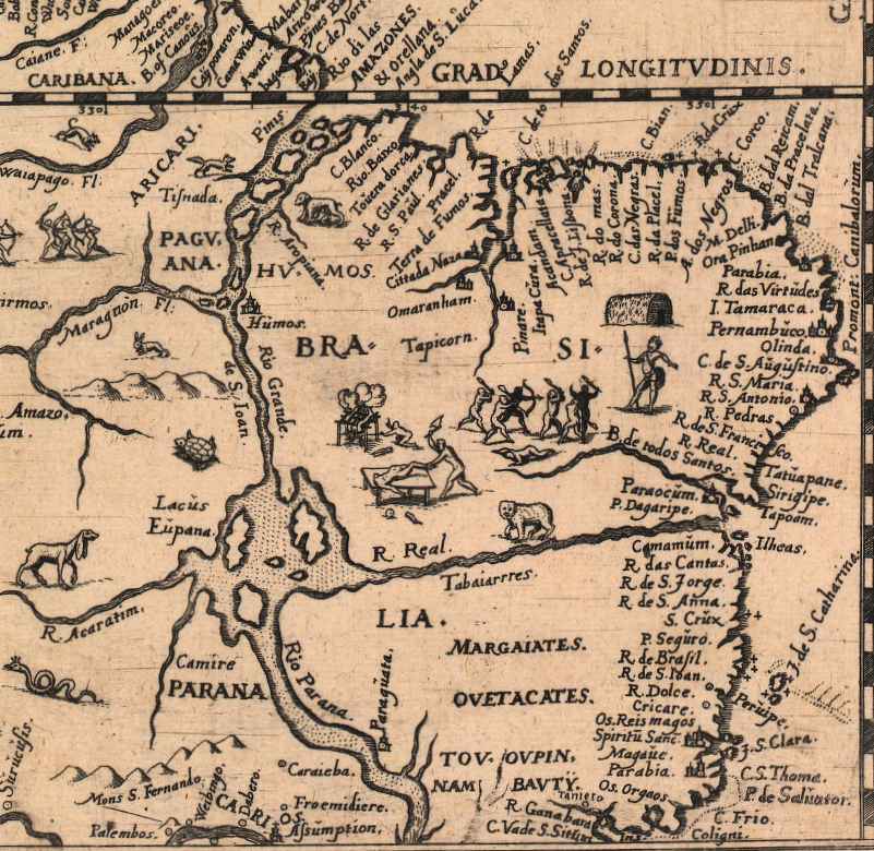
Brazilian 17th Century Map
Ancient Brazil Landscape: A classical rendering capturing early colonial settlements, dense native flora, and coastal terrains that initially met early European explorers.
The Amazon Basin: A breathtaking view of the modern, intricate web of fluvial networks running through the world's most vital rainforest ecosystem.