Global Position & Weather Patterns
Brazil stretches from about 5°N to 34°S — meaning most of the country sits inside the tropics, while its southern third reaches into the subtropics. That span puts Brazil across two very different pieces of global atmospheric circulation: the rising, rain-making branch of the Hadley cell near the equator, and the descending, drying branch of the same cell over the subtropics. Almost everything distinctive about Brazilian weather — the drenched Amazon, the parched interior Northeast, the four-season South — follows from where a given region sits inside that circulation.
Global Circulation Cells & the ITCZ
The Amazon Basin sits almost directly under the Intertropical Convergence Zone (ITCZ) — the belt where the northeast and southeast trade winds converge, forcing warm, moisture-laden air to rise, cool, and dump rain almost daily. This is the ascending branch of the Hadley cell, and it is the single biggest reason the Amazon is one of the wettest places on Earth. The ITCZ migrates seasonally, tracking the sun's overhead position and the warmest sea-surface temperatures; when it sits further south (roughly December–May) it drives the rainy season across northern and central Brazil, and when it shifts north the interior Northeast dries out. Southern Brazil, by contrast, lies outside the ITCZ's reach entirely and gets its rain from a completely different mechanism — the mid-latitude polar front, discussed below.
Wind Belt Systems
Brazil's weather is steered by two competing wind systems. The southeast trade winds, spinning off the semi-permanent South Atlantic High (a subtropical high-pressure cell centered over the ocean near 25°S), blow moisture off the Atlantic into the Amazon and the Northeast coast. But that same South Atlantic High also has a descending, stabilizing arm that suppresses rainfall over the Northeast's interior, helping create the semi-arid Sertão — a rain shadow effect produced not by mountains but by sinking, drying air on the high's western edge. Further south, Brazil comes under the influence of the mid-latitude westerlies and the polar front, where cold, dry air pushing up from Patagonia collides with warm, humid tropical air. These frontal collisions ("frentes frias") are what give southern and southeastern Brazil their much more variable, four-season weather — including the occasional winter cold snap (a friagem) that can push temperatures down to near freezing as far north as the southern Amazon, and rare light snow in the highlands of Santa Catarina and Rio Grande do Sul.
Global Precipitation Patterns
The result is one of the steepest rainfall gradients of any country on Earth: the northwestern Amazon can exceed 2,500mm of rain a year, while pockets of interior Bahia and Pernambuco fall below 500mm — closer to desert than rainforest, despite being at similar latitudes only a few hundred kilometers apart.
Approximate average annual precipitation by region. Bar length is scaled relative to the wettest region (Amazon Basin).
Severe Weather
Brazil's severe weather is regionally split: the tropical north deals with flooding and drought-driven wildfires, while the subtropical south — sitting under that same collision zone between tropical and polar air described above — is Brazil's tornado and severe-thunderstorm belt. (River and coastal flooding, plus Brazil's one confirmed hurricane, are covered in depth on the Floods, Trade & Coasts page.)
Tornadoes
Brazil is not usually associated with tornadoes, but Rio Grande do Sul, Santa Catarina, and Paraná sit at the northern edge of South America's own tornado corridor, driven by the same clash of warm subtropical air and cold polar outbreaks that fuels tornado alley in the United States. Outbreaks are less frequent and generally weaker than in the U.S. Midwest, but they are not rare, and 2025 produced Brazil's most violent tornado in decades.
Wildfires
Wildfire is Brazil's other major severe-weather hazard, and it is closely tied to drought rather than lightning: the overwhelming majority of fires in the Amazon and the Pantanal wetlands are started deliberately to clear land for farming and ranching, then spread out of control during abnormally dry, hot years. 2024 was Brazil's worst wildfire year in almost two decades, driven by the most severe drought the country had experienced in 70 years.
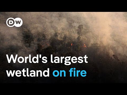 ►
Wildfires burn 700,000 hectares of Pantanal wetland
DW News — watch on YouTube ↗
►
Wildfires burn 700,000 hectares of Pantanal wetland
DW News — watch on YouTube ↗
A news report on the record-breaking 2024 fire season in the Pantanal, the world's largest tropical wetland. Opens on YouTube in a new tab.
Climate Classification (Köppen)
Because Brazil spans such a wide range of latitude, elevation, and distance from the ocean, it contains an unusually large share of the Köppen climate system's categories. Using the widely-cited 2014 reclassification by Alvares et al., Group A (tropical) climates cover about 81% of Brazil's territory, Group C (temperate) covers about 14%, and Group B (dry) covers the remaining 5% — concentrated almost entirely in the interior Northeast.

Köppen climate classification map of Brazil. Source: Peel, Finlayson & McMahon (University of Melbourne), via Wikimedia Commons.
How to Read It
Köppen climate codes combine a temperature/precipitation group (A = tropical, B = dry, C = temperate) with lowercase letters describing the seasonal rainfall pattern (f = no dry season, m = monsoon, w = dry winter, s = dry summer) and, for group C, a third letter describing summer heat (a = hot, b = warm). Brazil's climate map is essentially a story of latitude and distance from the equator/ocean, read through that code.
Af — Tropical Rainforest
Found across the core of the Amazon Basin. Rainfall in every month of the year, high year-round humidity, and almost no temperature variation (highs typically 30–32°C year-round). This is the ITCZ's direct footprint.
Am — Tropical Monsoon
A transitional zone along parts of the eastern Amazon and northern coast: a short, sharply defined dry season, but total annual rainfall still high enough to sustain rainforest.
Aw — Tropical Savanna
Brazil's most widespread climate type, covering most of central Brazil — home to the Cerrado biome. A pronounced dry winter (roughly May–September) alternates with a wet summer.
BSh — Hot Semi-Arid
The interior Sertão of the Northeast. Low, unreliable rainfall (often under 500mm/yr) concentrated in a brief rainy season, with multi-year droughts a recurring feature of life in the region.
Cwa / Cfa — Humid Subtropical
Covers the southeastern plateau (São Paulo, Minas Gerais highlands — Cwa, dry winter) and most of southern Brazil (Cfa, no real dry season). Four distinguishable seasons, hot summers, occasional winter frost.
Cfb — Temperate Oceanic
The cool, high-elevation pockets of the far south (highland Santa Catarina and Rio Grande do Sul). Mild summers, cold winters, and Brazil's only areas that occasionally see frost or light snowfall.
Biomes
Brazil recognizes six major continental biomes, and because each formed under a different climate regime described above, biome boundaries in Brazil track climate boundaries closely. Together they hold an estimated 20% of all species on Earth.

Cerrado savanna, Chapada dos Veadeiros, Goiás — Brazil's tropical savanna biome and its agricultural frontier.
Unifying or Dividing?
Both. Nationally, biomes like the Amazon function as a unifying source of pride and identity — "Amazônia" is central to how Brazil presents itself internationally. But within the country, biomes map closely onto regional economic inequality: the Caatinga's chronic drought underlies the Northeast having Brazil's highest poverty rates (the bottom 50% of Northeasterners earn roughly half the income share of the bottom 50% in the wealthier South), while the Cerrado and Amazon are also frontlines of conflict between agribusiness expansion and Indigenous and traditional communities. Even biome-linked regional culture is a double-edged unifier — the Pampa's gaúcho identity in Rio Grande do Sul is a strong source of local pride, but also reinforces a distinct regional identity that sets the South apart culturally from the rest of the country.
Native Plants
Brazil holds roughly a quarter of the world's known plant species. Many are the source of major export commodities and traditional medicines; a smaller number are genuinely dangerous.

Useful: Food & Resources
Brazil nut (Bertholletia excelsa): a canopy tree of the Amazon whose woody pods, each containing 10–25 seeds, depend entirely on large native bees for pollination and agoutis (rodents) for seed dispersal — meaning the nut can only be harvested from intact rainforest, not plantations. Açaí and guaraná (with roughly twice the caffeine concentration of coffee beans) are both Amazon natives now sold worldwide. Pau-brasil (brazilwood) — the tree Brazil is named after — was harvested by early colonists for a valuable red dye. The rubber tree (Hevea brasiliensis), native to the Amazon, once made Brazil the world's dominant natural-rubber supplier.
Dangerous: Poisonous Plants
A 2007 survey of just Northeast Brazil catalogued 483 plant species used medicinally or as poisons, 27 of them exclusively toxic. The most dramatic is the Amazonian assacu or sandbox tree (Hura crepitans): its latex sap can blister skin and cause temporary blindness, its seeds contain a toxic lectin, and its pods explode when ripe, firing seeds up to 70 m/s — Indigenous communities have long used its sap to poison fishing arrows and stun fish. In the drought-adapted Caatinga, several native cacti and euphorbias carry irritant or toxic sap as a defense against the region's scarce rainfall and grazing pressure.
Native Animals
Brazil's fauna includes species that are directly useful to people — for food, medicine, or transport history — alongside some of the most medically significant venomous animals in the world.
%20male%20Three%20Brothers%20River%202.jpg)
Useful: Resources & Medicine
The Amazon's pirarucu, one of the world's largest freshwater fish, is a major subsistence and commercial food source, and sustainable-harvest programs for it now support entire river communities. Native bees are the sole pollinator of the (economically vital) Brazil nut tree. Most strikingly, the venom of the jararaca pit viper (Bothrops jararaca) — collected and studied by Brazilian pharmacologist Sérgio Ferreira in the 1960s — led directly to captopril, the first ACE-inhibitor drug, now used worldwide to treat high blood pressure and heart failure: a dangerous native animal that became a major medical breakthrough.
Dangerous: Venomous & Predatory
The jararaca above is also responsible for the majority of Brazil's snakebite envenomations. The Brazilian wandering spider (Phoneutria) carries a neurotoxic venom that can cause severe pain and, rarely, fatal respiratory failure, and is known for wandering into homes and clothing rather than staying in webs. Amazon rivers hold the electric eel (capable of an 860-volt shock) and shoals of piranha. The jaguar (Panthera onca) — the Americas' largest cat, pictured here in the Pantanal — is an apex predator across the Amazon, Cerrado, and Pantanal, and while attacks on people are rare, it preys heavily on cattle in ranching areas, a recurring source of human-wildlife conflict.
Sources & References (APA)
- Alvares, C. A., Stape, J. L., Sentelhas, P. C., de Moraes Gonçalves, J. L., & Sparovek, G. (2013). Köppen's climate classification map for Brazil. Meteorologische Zeitschrift, 22(6), 711–728. schweizerbart.de
- Britannica. (2024). Brazil: Climate. britannica.com
- Britannica. (2024). South America: Factors influencing climate. britannica.com
- Wikipedia contributors. (2025). South Atlantic High. en.wikipedia.org
- Nature Scientific Reports. (2019). Tropical South Atlantic influence on Northeastern Brazil precipitation and ITCZ displacement during the past 2300 years. nature.com
- Watchers.news. (2025). Rio Bonito do Iguaçu tornado upgraded to EF-4, placing Brazil among sites of 2025's most violent tornadoes worldwide. watchers.news
- Al Jazeera. (2025, November 9). Powerful tornado wrecks Brazil town, killing six and injuring hundreds. aljazeera.com
- Wikipedia contributors. (2025). 2018 South America tornado outbreak. en.wikipedia.org
- Center for Disaster Philanthropy. (2024). 2024 Brazil wildfires. disasterphilanthropy.org
- Earth.Org. (2024). Drought-stricken Brazil sees 80% yearly rise in wildfires in 2024. earth.org
- Wikipedia contributors. (2025). 2020 Brazil rainforest wildfires. en.wikipedia.org
- DW News. (2024, June). Wildfires burn 700,000 hectares of Pantanal wetland [Video]. YouTube. youtube.com
- Agência Brasil. (2019). New map details Brazil's six major continental biomes. agenciabrasil.ebc.com.br
- Rio Times. (2024). Brazil's biomes and their characteristics. riotimesonline.com
- World Resources Institute. (2024). In Brazil's drought-ravaged Caatinga ecosystem, small farmers know best. wri.org
- Silva, M. S., et al. (2007). Synopsis of the plants known as medicinal and poisonous in Northeast of Brazil. Revista Brasileira de Farmacognosia. scielo.br
- PlantCareToday. (2024). The lethal sandbox tree — Hura crepitans. plantcaretoday.com
- World Atlas. (2023). Native plant species of Brazil. worldatlas.com
- Britannica. (2024). Brazil nut tree. britannica.com
- Pharmaceutical Journal. (2013). From snake venom to ACE inhibitor — the discovery and rise of captopril. pharmaceutical-journal.com
- Animals Around The Globe. (2024). Five most dangerous animals in South America. animalsaroundtheglobe.com
- JTG Travel. (2024). The 9 most dangerous animals in Brazil: Wildlife guide. jtgtravel.com
- Images: Wikimedia Commons — Brazil Köppen Climate Map (Peel, Finlayson & McMahon, Univ. of Melbourne), Cerrado, Chapada dos Veadeiros, Brazil nut fruit and seeds, Jaguar, Three Brothers River (Charlesjsharp).